U.S. flag

An official website of the United States government

Earthquake Hazards Program

The USGS monitors and reports on earthquakes, assesses earthquake impacts and hazards, and conducts targeted research on the causes and effects of earthquakes. We undertake these activities as part of the larger National Earthquake Hazards Reduction Program (NEHRP), a four-agency partnership established by Congress.

News

USGS Announces Recipients of Recent Earthquake Research Grants and Cooperative Agreements

USGS Announces Recipients of Recent Earthquake Research Grants and Cooperative Agreements

M7.7 Mandalay, Burma (Myanmar) Earthquake

M7.7 Mandalay, Burma (Myanmar) Earthquake

USGS Seeks Earthquake Hazards Research Proposals

USGS Seeks Earthquake Hazards Research Proposals

Publications

High-pass corner frequency selection and review tool for use in ground-motion processing High-pass corner frequency selection and review tool for use in ground-motion processing

Raw seismological waveform data contain noise from the instrument’s surroundings and the instrument itself that can dominate recordings at low and high frequencies. To use these data in ground‐motion modeling, the effects of noise on the signals must be reduced and the signals’ usable frequency range identified. We present automated procedures to efficiently reduce low‐frequency noise...
Authors
Maria E. Ramos-Sepulveda, Scott J. Brandenberg, Tristan E. Buckreis, Grace Alexandra Parker, Jonathan P. Stewart

An empirical Green’s function approach for isolating directivity effects in earthquake ground-motion amplitudes An empirical Green’s function approach for isolating directivity effects in earthquake ground-motion amplitudes

In this study, we apply an empirical Green’s function (eGf) method within a ground‐motion modeling framework to mitigate trade‐offs between source, path, and site effects. Many physical processes contribute to spatial variations in observed ground motions, including earthquake radiation pattern, directivity, variable path attenuation, and site effects. Current nonergodic ground‐motion...
Authors
Grace Alexandra Parker, Annemarie S. Baltay Sundstrom, Evan Tyler Hirakawa

Bayesian ETAS modeling for the Pacific Northwest: Uncovering effects of tectonic regimes, regional differences, and swarms on aftershock parameters Bayesian ETAS modeling for the Pacific Northwest: Uncovering effects of tectonic regimes, regional differences, and swarms on aftershock parameters

The Pacific Northwest (PNW) of North America has high seismic hazard due to numerous earthquake sources under populated areas. It hosts several tectonic regimes and subregional seismic zones that are hypothesized to have different patterns of earthquake and aftershock occurrence. It is also predisposed to earthquake swarms, which can complicate the statistical modeling of these patterns...
Authors
Max Schneider, Michael Barall, Peter Guttorp, Jeanne L. Hardebeck, Andrew J. Michael, Morgan T. Page, Nicholas van der Elst

Science

2025 Puerto Rico and U.S. Virgin Islands Long-term National Seismic Hazard Model

We anticipate the final 2025 PRVI NSHM to be available by December 21st 2025.
2025 Puerto Rico and U.S. Virgin Islands Long-term National Seismic Hazard Model

2025 Puerto Rico and U.S. Virgin Islands Long-term National Seismic Hazard Model

We anticipate the final 2025 PRVI NSHM to be available by December 21st 2025.
Learn More
Public kickoff webinar: 2026 National Seismic Hazard Models for Guam & Northern Mariana Islands and American Samoa

Public kickoff webinar: 2026 National Seismic Hazard Models for Guam & Northern Mariana Islands and American Samoa

Monday, February 24, 2025 2:00-4:00 pm MST A Virtual Meeting
Learn More

M 6.9 October 17, 1989 Loma Prieta Earthquake

The 1989 Loma Prieta earthquake ended decades of tranquility in the San Francisco Bay region. It was a wakeup call to prepare for the potentially even more devastating shocks that are inevitable in the future. Since 1989, the work of the U.S. Geological Survey and other organizations has improved understanding of the seismic threat in the Bay region, promoted awareness of earthquake hazards, and...
M 6.9 October 17, 1989 Loma Prieta Earthquake

M 6.9 October 17, 1989 Loma Prieta Earthquake

The 1989 Loma Prieta earthquake ended decades of tranquility in the San Francisco Bay region. It was a wakeup call to prepare for the potentially even more devastating shocks that are inevitable in the future. Since 1989, the work of the U.S. Geological Survey and other organizations has improved understanding of the seismic threat in the Bay region, promoted awareness of earthquake hazards, and...
Learn More

Multimedia

10 Largest Earthquakes Ever Recorded
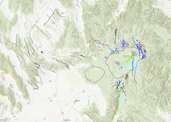
Snapshot of QFaults for the area including Yellowstone National Park
Seismic hazard model for Hawaii from 2021 showing peak ground acceleration where warmer colors are higher levels.
A cross section through the area of Anchorage, AK showing earthquakes at depths along with subduction model linework from Slab2 and inputs from the 2007 NSHM.
Alaska cross section from the 2023 NSHM
Shake Movie for M5.2 Julian earthquake Thumbnail Shake Movie for M5.2 Julian earthquake
Shake Movie for M5.2 Julian earthquake
man in front of a graphic for PAGER USGS PAGER during the Magnitude 7.7 2025 Mandalay, Burma (Myanmar) Earthquake
USGS PAGER during the Magnitude 7.7 2025 Mandalay, Burma (Myanmar) Earthquake
Aftershock Forecast Sequence-Specific Model Parameters
AftershockForecastSequence-SpecificModelParameters.png
An example of Bayesian updating of productivity parameter (a-value) for the 2010 Mw 8.8 Maule, Chile, earthquake. Immediately following the earthquake, the SZ-GENERIC region-specific a-value distribution can be used. As the aftershock sequence progresses and additional data are collected, this distribution can be treated as a prior distribution and updated using Bayes’ rule. Posterior distributions at subsequent time intervals are shown. Figure from Page et al. (2016).
AftershockForecastfig6.gif
Screenshot of the Aftershock Forecast for an earthquake in California, showing the information box at the top of the forecast and the four tabs of forecast information.
Mendocino_headerinfo-2.jpg
Was this page helpful?